SKYFRAME AERIAL

Aerial imaging for Revelstoke.

Roof inspections, photography and RGB mapping, flown out of Revelstoke and delivered to your inbox, usually inside 48 hours. Transport Canada Advanced Operations Certified, Insured Operator.

REVELSTOKE, BC · 50.9981° N 118.1957° W · 450 M ASL

0 25 M

Three ways to get the picture.

Every job is flown, processed and delivered by a Revelstoke resident. No subcontractors, no outsourcing, no stock footage. Pricing below is a starting point; larger sites and repeat visits are quoted by the job.

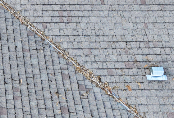
view of drain on roof clogged with brances and cedar needles.
ROOF INSPECTION · GEOTIFF + PDF

Hi-Res Roof Inspection and Property Orthomosaic

Close range capture of every roof plane, plus a stitched top down image of the whole property that you can measure directly. Find lifted shingles, cracked flashing and ice dam damage without putting anyone on a ladder. Useful for year over year evidence of maintenence to an insurance company, before a sale, after a storm, or every spring.

  • Full roof coverage, all slopes and penetrations
  • Measurable orthomosaic of the lot
  • PDF report
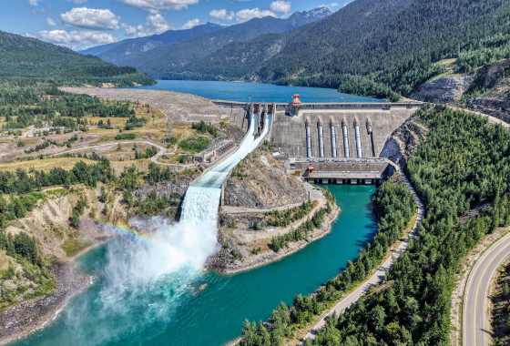
Revelstoke Dam spilling with a rainbow coming from the spillway.
4K/60FPS VIDEO · 50 MP STILLS · COLOUR GRADED

Aerial Photography and Video

Stills and 4K video of neigbourhood, property, buildings, events and terrain. Shot for real estate listings, construction progress and marketing, then colour-graded and handed over in web and print sizes, ready to post the same week.

  • Edited stills, full resolution and web optimized
  • Short form cuts for listings and socials
  • Digital delivery, no meetups required

From$199

Book a shoot
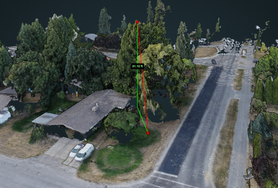
3D Measurment of a tree on a property
3D SITE RECREATION · OBJECT MEASURMENT · DIGITAL TWIN

Map Creation and Data

Orthomosaics, 3D Modeling, digital surface models, contour lines and volume measurements for stockpiles, cut and fill and site planning. Exports drop straight into CAD, GIS and estimating software, so your engineer or surveyor can work from them without conversion. Accurate down to 0.5m

  • Georeferenced orthomosaic and elevation model
  • Stockpile Calculations
  • Ortho Photos, Surface Models, Point Clouds and Textured Models

Tell us what you need flown.

Leave a name and number and Jay will call you back, usually the same day, to talk through the site, the weather window and an estimate.

Email

jay (at) skyframeaerial.ca

Phone

236-837-9006

Based in

Revelstoke, British Columbia

We only use your number to return your call about this job.